
Beyond the Tides: Navigating the Peninsula Trails of Cobscook Bay State Park

Reading the Maritime Rhythm of Cobscook Bay
Cobscook Bay State Park is not simply a campground with a few pleasant walks attached. It is a coastal ecosystem in constant motion, shaped by ancient volcanic bedrock, glacial deposits, spruce-lined peninsulas, saltwater coves, and tides that average roughly 24 feet and can reach 28 feet. The landscape sits in easternmost Maine, where the boreal forest approaches the ocean and the boundary between land and water is redrawn twice each day.
The park”s geography is correspondingly intricate. Jagged points extend into Whiting Bay, Burnt Cove, and the wider Cobscook system, while sheltered coves collect mud, gravel, eelgrass, and drifting seaweed. A visitor looking across the same shoreline at morning high tide and afternoon low tide may seem to be viewing two different places. For anyone exploring beyond the campground roads, trail distance is only part of the calculation. Water level, fog, wet ground, wind direction, and the timing of the falling tide determine what can be seen, where footing is secure, and how long a route will take. The broader Whiting Bay coastal network can complement the state park, but every outing benefits from the same tide-conscious approach.
Navigating Spruce Roots and Lichen Along the Nature Trail
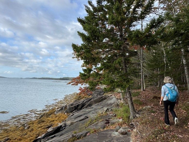
The 1.2-mile Nature Trail offers one of the best introductions to Cobscook”s interior terrain. It moves through maritime spruce and fir forest, follows a brook, and eventually reaches overlooks above Whiting Bay and Burnt Cove. The route is generally accessible to hikers who are comfortable with easy woodland trails, but it should not be mistaken for a uniformly smooth path. A short, steep, rocky section becomes notably more demanding after rain, during spring thaw, or whenever fog leaves the exposed stone damp.
Underfoot, the trail reveals a layered coastal geology. Exposed roots form low webs across the path where shallow soil covers glacial till. In lower sections, the ground may feel soft and dark with moisture, particularly near stream gullies and shaded depressions. Moss and lichen spread over stones at the forest edge, producing a surface that can look stable while offering very little traction. The transition from forest to overlook can be abrupt, with a wooded gully opening onto saltwater, gravel shore, distant islands, and working waters where lobster boats may appear through breaks in the spruce.
Footwear should be selected for stability rather than appearance. Waterproof hiking shoes or boots with a firm tread are useful, while smooth-soled sneakers are a poor choice on mossy rock and wet roots. Trekking poles can help on the steeper section, especially for hikers carrying camera equipment or packs. Keep groups together, slow down at changes in surface, and allow extra time when conditions are muddy. The Maine trail safety guidance is worth reviewing before departure, particularly for spring flooding, insects, changing weather, and wet maritime forest floors.
- Place each foot deliberately on roots and rock rather than stepping quickly across the entire surface.
- Pause before stream crossings and inspect whether water has altered the trail edge.
- Carry a light rain shell, even under a clear morning forecast, because coastal fog and showers can arrive quickly.
- Keep dogs leashed and prevent them from scrambling onto fragile moss, lichen, or overlook vegetation.
Tidal Dynamics and Shifting Mudflats Across Whiting Bay
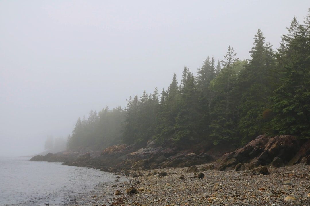
A shoreline route around Whiting Bay changes character more dramatically than its modest mileage suggests. At high tide, the bay presses against the forest edge, filling channels and leaving only narrow strips of gravel or rock visible. The water reflects the dark spruce canopy and turns small coves into quiet inlets. At low tide, the same shoreline opens into broad mudflats marked by rivulets, exposed stones, eelgrass, and bands of drying seaweed. These are not merely scenic variations. They affect access, footing, wildlife activity, and the apparent shape of the peninsula.
At full flooding, the best views usually come from elevated overlooks and firm shore sections. The water creates a continuous surface toward Bar Island and the outer bay, and birds may be concentrated along the narrow remaining margins. As the tide recedes, feeding areas expand. Shorebirds track the waterline across newly exposed mud, probing for invertebrates, while gulls and crows work the upper wrack line. Bald eagles and other raptors may use trees or ledges above the bay, watching the productive intertidal zone below. The park”s coves, mudflats, and eelgrass beds support more than 200 bird species across the year, making tide timing an important part of naturalist observation.
Do not treat exposed mudflat as an invitation to shortcut along the water. Fine sediment can be unstable, channels may be deeper than they appear, and the returning tide can move faster through narrow coves than expected. Keep waterfront campsites and low shore ledges out of the route plan unless the access is clearly secure. A tide table, a watch, and a conservative turnaround time are more reliable than judging conditions by sight alone.
| Water level | What the landscape offers | Primary concern |
|---|---|---|
| High tide | Continuous bay views, flooded coves, concentrated shorebird edges | Narrow shore margins and fast-moving water near channels |
| Falling tide | Expanding gravel, seaweed bands, feeding flats, visible tidal channels | Unstable mud and the need to monitor the return tide |
| Low tide | Broad mudflat patterns, exposed stones, detailed views of the intertidal food web | Soft sediment, deep rills, and long distances back to firm ground |
Interior Canopy Rhythms and Boreal Wildlife Enclaves
The forest interior rewards a slower pace than the overlooks. Red spruce, balsam fir, and cedar create several distinct vertical layers, from low, dense growth to taller trees with open perches. Bird activity often changes with those layers. High-canopy singers may be heard before they are seen, their calls moving through the upper branches, while chickadees, sparrows, and other ground-foraging species stay closer to damp underbrush, brook margins, and fallen timber.
Early morning is often the most productive period for listening. Stop at trail junctions, stream crossings, and openings where sound carries, then identify whether a call is coming from the canopy, midstory, or forest floor. Boreal birding resources such as the Maine boreal bird guide can help distinguish habitat preferences and vocal clues. Look also for indirect evidence. Bark stripped from spruce may suggest woodpecker activity, while berry patches, browse lines, tracks, and scat reveal how mammals use the forest margins.
Snowshoe hare and white-tailed deer may leave the clearest signs, particularly where woodland meets open shore or road edges. Black bear traces are possible as well, although a sign of bear activity is a reason to increase distance, not an opportunity to search for the animal. Food, toiletries, cooking supplies, and trash should be secured according to state park wildlife precautions. Quiet observation protects both visitors and animals, especially during nesting, migration, and the summer season when insect pressure encourages wildlife to concentrate in sheltered cover.
- Use binoculars instead of approaching birds or mammals for closer views.
- Remain on established paths near shorelines and stream gullies.
- Do not play recorded calls repeatedly or use loud pishing where birds are feeding or nesting.
- Pack out all food scraps, fishing line, and other small debris.
- Give bears, deer, and any animal with young a wide route and an unobstructed escape path.
Connecting Shorelines Across the Outer Reaches of Trescott and Edmunds
For a longer coastal day, hikers can connect the state park experience with nearby Cobscook Shores properties in Trescott and Edmunds. Whiting Bay Beach offers a short but varied trail network, including the approximately one-third-mile Peninsula Loop and a Birch Beach Spur of about 1,000 feet. The Peninsula Loop is notable for its 270-degree panorama of Whiting Bay and Bar Island, but its compact distance should not obscure the terrain. Steep slopes, narrow sections, exposed roots, and changing surfaces require careful foot placement.
The comparison with Cobscook Bay State Park is useful. State park trails provide a stronger forest-and-overlook experience, with the Nature Trail moving inland before revealing the bay and the Shore Trail combining woodland with waterfront sections. Whiting Bay Beach feels more openly maritime, with gravel beaches, shore access, a picnic pavilion, and a hand-carry boat launch usable around mid to high tide. The northern beaches and Birch Beach Spur bring hikers close to the intertidal margin, where tide timing becomes even more important. Carry-in, carry-out practices, leashed dogs, and the site”s seasonal operating hours should be respected.
A well-sequenced day can capture both the shaded boreal forest and the broad, changing views of the bay without forcing a rushed route. The following order works well for many visitors, provided current conditions and tide predictions support it:
- Begin with the Nature Trail in the cooler morning air, when bird calls are easier to hear and shaded ground is less slick from midday activity.
- Move to the state park shoreline or an elevated Whiting Bay overlook near a planned tide stage, allowing time to observe the waterline rather than simply passing through.
- Drive to Whiting Bay Beach and walk the Peninsula Loop for its wide panorama, then consider the Birch Beach Spur only if the tide, footwear, and daylight provide comfortable margins.
- Finish on firm ground at the picnic pavilion or gravel shore, checking gear for ticks, mud, and moisture before the return drive.
Step Wisely Along the Shifting Edge of Downeast Maine
A complete Cobscook hiking strategy joins three kinds of awareness: tide awareness, precise foot placement, and naturalist curiosity. The 24-foot tidal range gives the bay its ecological richness, but it also means that a route can become narrower, wetter, or more isolated within a few hours. Check tide predictions and weather before leaving, carry navigation and rain gear, and build a turnaround point into every shoreline outing. Interior trails deserve the same care, since roots, glacial stone, mud, and fog can slow progress even when the map shows only a short distance.
Respectful exploration keeps this landscape healthy. Stay on durable surfaces, avoid trampling salt-marsh edges and intertidal vegetation, keep wildlife wild, and remove every piece of food and waste. In spring, expect flooding and mud; in summer, prepare for black flies, ticks, and sudden showers; in autumn, watch for shorter daylight and slick leaf cover; in winter, treat ice and changing snow conditions conservatively. Cobscook Bay reveals its character gradually, through the movement of birds, the return of water across the flats, and the quiet pulse of spruce forest above the shore. A careful visitor does more than cross the peninsula trails. The changing edge becomes the guide.