
Rhythms of the 24-Foot Tide: How Ocean Surges Shape Life in Cobscook Bay

The Massive Tidal Pulse of Downeast Maine
Along the spruce-lined shores of Cobscook Bay, the sea does not simply rise and fall. It advances across mudflats, streams through narrow passages, lifts floating forests of rockweed, and then withdraws far enough to expose a broad working landscape of stone and sediment. Tidal variation can reach approximately 24 feet over a cycle, with major changes occurring roughly every six hours. For visitors seeking a deeper understanding of Cobscook Bay”s coastal diversity, the tide is the essential starting point. It governs when shorebirds feed, when clams can be harvested, when channels become hazardous, and when familiar coves appear almost transformed.
This exceptional movement is connected to the larger hydraulic system of the Gulf of Maine and the Bay of Fundy. The shape of the gulf, the narrowing geometry of the bay, the depth of underwater basins, and the timing of incoming tidal waves combine to amplify water-level changes along the Downeast coast. The result is not merely a dramatic natural spectacle. It is a dependable ecological engine that circulates nutrients, creates alternating marine and terrestrial conditions, and has shaped generations of fishing, shellfish harvesting, boat travel, and coastal settlement.
Physics of the Surge and the Bay of Fundy Funnel
The Bay of Fundy is famous for its large tides because its length and geometry encourage a form of natural resonance. The incoming tidal wave entering the Gulf of Maine interacts with the basin”s shape and depth, and the timing of that movement can reinforce the rise and fall rather than cancel it. Tidal range varies considerably from one location to another, but the general pattern is clear: water is gathered and redirected through a complex system of channels, headlands, islands, and submerged valleys.
Cobscook Bay functions as a convoluted sub-basin within this larger system. As enormous volumes of seawater move through restricted openings, the flow accelerates and changes direction around points and islands. In some passages, the principal challenge is the height of the tide; in others, it is the speed of the horizontal current. A high-resolution hydrodynamic model developed for the Bay of Fundy examined water levels, current velocities, and changing energy across areas including Western Passage and Head Harbour Passage. The Natural Resources Canada hydrodynamic report demonstrates why tide tables alone do not tell the whole story. Local channel shape and the phase of the tide determine what the water is doing at a particular point.
| Coastal setting | Typical tidal character | What it means on the ground |
|---|---|---|
| Many open Atlantic shores | Modest to moderate tidal range | Intertidal habitat is exposed, but the vertical change is often less dramatic |
| Gulf of Maine coast | Substantial semidiurnal tides | Rocky shores, marshes, and beaches can change noticeably during a day |
| Cobscook Bay and nearby passages | Extreme range, locally approaching 24 feet | Broad mudflats emerge, channels accelerate, and access routes can change rapidly |
The same physics that attracts marine-energy researchers also demands caution from recreational users. Maine”s Department of Environmental Protection notes that tidal energy potential is especially significant where large tidal ranges meet narrow, fast-moving channels, while also emphasizing that environmental effects and practical feasibility require careful evaluation. Cobscook Bay has hosted tidal-energy testing, including systems designed to use moving water rather than a conventional dam. Such projects offer a useful reminder that the bay”s motion is measurable kinetic energy, not an abstract scenic feature. The flow carries enough force to shape sediment, move drifting seaweed, and challenge an unwary vessel.
Rockweed Forests and the Exposed Intertidal Zone
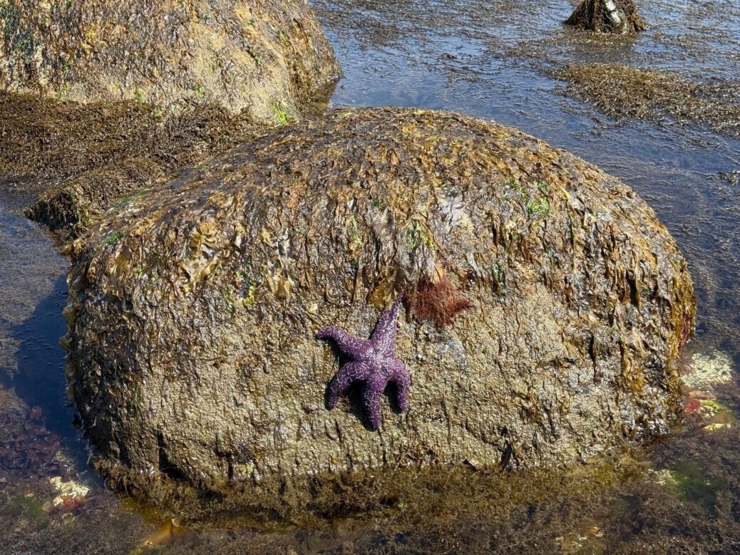
At low tide, knotted wrack and bladder wrack can look like limp brown ribbons scattered over dark rock. In ecological terms, however, these seaweeds form a living blanket. Their dense mats retain moisture, shade small organisms from direct sun and wind, and soften the temperature extremes that accompany aerial exposure. When the tide returns, the same vegetation rises into an underwater forest, creating cover for juvenile fish and feeding habitat for a wide range of invertebrates.
Rockweed beds are particularly important because Cobscook”s intertidal zone is neither a simple line between land and sea nor a uniform strip of bare rock. It is a layered habitat used differently as the water rises and falls. Observations and research summarized by local coastal educators have associated rockweed with dozens of marine animals and plants, including periwinkles, crabs, limpets, amphipods, clams, eels, and small fish. Juvenile herring, pollock, and winter flounder can use the submerged canopy as refuge, while common eider ducklings forage among the vegetation for small crustaceans and snails. The habitat-forming role of seaweed is also reflected in broader research on intertidal seaweed responses to heat and aerial stress.
- Rockweed holds water against the shore during low tide, reducing drying stress.
- Its branches provide hiding places from predators and shelter from waves and currents.
- The canopy supports small grazers, which in turn feed fish, seabirds, and larger invertebrates.
- Detached seaweed can remain valuable as floating habitat or as decomposing material that returns nutrients to the shore.
Shore organisms survive this alternating exposure through specialized adaptations. Periwinkles clamp tightly to rock or retreat into damp vegetation. Mussels close their shells to conserve water. Anemones and other soft-bodied animals contract or remain in shaded crevices. Crabs seek cover beneath stones and seaweed, while worms remain within sediment where moisture and temperature are more stable. Visitors exploring at low tide should step carefully and avoid pulling rockweed from attached beds. A single plant may appear insignificant, but a dense bed is habitat infrastructure, and repeated disturbance can reduce the shelter available to an entire intertidal community.
Life Within the Expansive Mudflats at Low Tide
Every outgoing surge reveals thousands of acres of soft sediment across suitable parts of the bay and neighboring Downeast estuaries. These mudflats may appear quiet from a distance, but their surface is underlain by an active community of burrowing animals. Fine particles trap organic matter, while tidal circulation delivers nutrients and oxygenated water. The coastal geologic environments mapped by the Maine Geological Survey include intertidal mud flats, channels, marshes, beaches, and rocky settings, showing how varied the shoreline can be from one cove to the next.
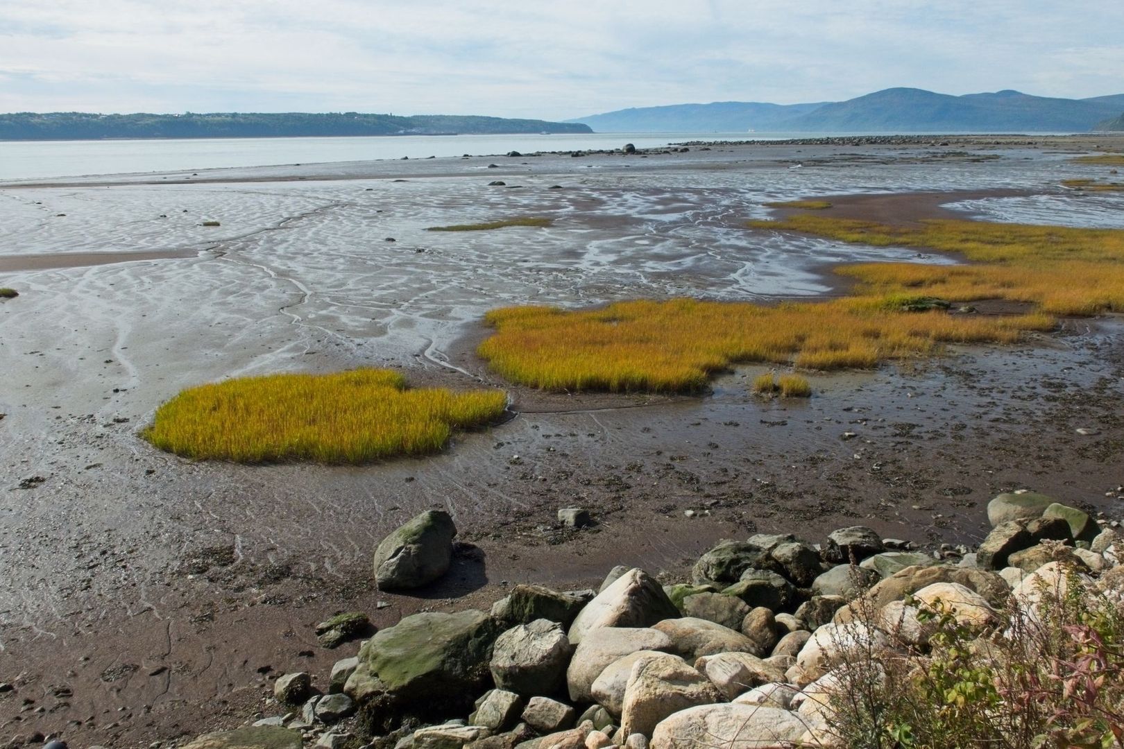
Soft-shell clams, bloodworms, and sandworms are among the most familiar residents of these sediments. Their burrows aerate the mud and provide food for fish and migratory shorebirds. When flocks arrive during migration, the feeding landscape becomes visibly animated: birds probe the surface with bills, follow retreating water, and concentrate where prey density is highest. The same productive ground supports human harvesters, linking local economies and cultural traditions to the timing and condition of the tide.
- Soft-shell clams support commercial, recreational, and traditional harvesting.
- Bloodworms and sandworms are important bait resources and contribute to the food web.
- Migratory shorebirds depend on exposed flats for concentrated feeding opportunities.
- Fine sediments can retain pollutants, making water quality and monitoring essential.
The economic value is substantial as well as ecological. Research and monitoring summarized by the Schoodic Institute placed Hancock County”s 2020 soft-shell clam industry at approximately $2.56 million, while bloodworm and sandworm industries together were valued at about $1.31 million. Those figures do not capture the full cultural value of Wabanaki and local harvesting traditions, nor the ecological service provided by mudflats to birds and finfish. Sustainable use depends on restraint, local rules, accurate identification, and respect for closed areas or conservation zones. Mudflat biodiversity can change over time with sediment movement, water quality, warming conditions, invasive species, and shoreline alteration, so continued monitoring is as important as harvesting itself.
Navigating Reversing Falls and Coastal Currents Safely
In narrow passages, the incoming and outgoing tides can produce reversing falls, whirlpools, boils, and standing waves. These features are generated when water levels on either side of a constriction differ enough to drive powerful flow through it. The surface may look deceptively smooth at one moment and turbulent soon afterward. Kayakers and small-boat operators must also account for wind, fog, swell, vessel traffic, cold water, and the possibility that an apparently short crossing will become difficult during a changing tide.
- Study the tide before departure. Use a current-aware tide source, not only a general high- and low-water listing. Local timing can differ between nearby coves and passages.
- Identify slack water carefully. Slack is a brief transition, not a guarantee of calm conditions. Wind against current can maintain steep or confused waves even near the turn.
- Read the surface continuously. Look for standing waves, slick lines, whirlpools, boils, foam trails, and abrupt changes in current direction.
- Leave a margin for error. Build in time for loading, navigation mistakes, weather changes, and slower-than-expected progress.
- Carry appropriate safety equipment. A properly fitted flotation device, communication method, chart, spare clothing, and reliable navigation tools are essential in cold coastal water.
Local knowledge is especially valuable in Cobscook Bay because the safest route can change with the tide. A channel that is manageable on one phase may become hazardous on another, and a sheltered shoreline can offer little protection once current and wind align. The Maine regulatory guidance on tidal-energy development underscores the strength and complexity of these flows, while hydrodynamic modeling of the region shows that velocity varies through the water column and across each passage. For unfamiliar visitors, guided trips, harbor advice, and conservative route planning are sensible choices. Never rely on visual distance alone, and do not walk across mudflats or tidal channels without a dependable local understanding of the return route.
Experiencing the Living Rhythm of Cobscook Bay
The 24-foot tide is best understood as continuous renewal rather than an isolated natural record. Rising water reconnects coves, transports plankton and nutrients, fills rockweed forests, and gives fish access to shallow nursery areas. Falling water concentrates prey for birds, exposes shellfish habitat, and reveals the intricate boundaries among marsh, mud, gravel, and stone. Each phase reorganizes the bay, and each season adds another layer through migration, spawning, storm activity, and changing daylight.
To experience that rhythm responsibly, plan to remain along the shore for several hours instead of arriving only for a quick low-tide photograph. Watch how channels widen, how birds follow the waterline, and how rockweed changes from a dry-looking mat to a buoyant underwater canopy. Keep a safe distance from nesting and feeding wildlife, leave living shore communities in place, follow harvest regulations, and treat working waterfronts as active places rather than scenery. A full tide cycle, observed patiently through changing light, is the clearest way to understand Cobscook Bay”s character. The landscape is not static, and its most important story is written in motion.