
The Hydraulic Marvel of Reversing Falls: How Tidal Currents Defy River Flow

The Shoreline Mechanics of Cobscook Falls
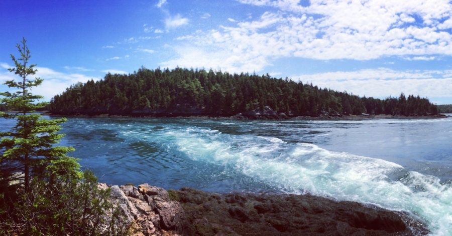
At Mahar Point in Downeast Maine, the shoreline does not simply meet the sea. It becomes part of a powerful tidal machine. Traditionally known as Cobscook Falls, Reversing Falls occupies the narrow passage between Mahar Point and Falls Island, where water moves between Dennys Bay and Whiting Bay. The surrounding preserve offers a relatively short walk to rocky viewpoints, yet the scene can change dramatically within a single tidal cycle, shifting from quiet water to a turbulent channel marked by swells, whirlpools, and standing waves.
Static river rapids generally run in one direction, their force governed by elevation and downstream discharge. Cobscook Falls behaves differently. Here, the gravitational pull of the moon, reinforced by the broad tidal range of the Bay of Fundy, repeatedly drives water through the same constriction in opposite directions. Water levels may rise or fall by as much as 24 feet over approximately 6.4 hours, and the most dramatic hydraulic action develops around mid-tide rather than at the brief interval of slack water. During an active cycle, expect shifting currents, boiling patches, abrupt surface changes, seals and raptors nearby, and a landscape that rewards patient observation rather than a quick photograph.
Submerged Topography and the Mahar Point Pinch Point
The essential geography is compact but consequential. Mahar Point and Falls Island form a narrow passage connecting Dennys Bay and Whiting Bay, concentrating a vast volume of moving seawater into a restricted channel. The channel”s shape, depth, and underwater obstructions determine how the incoming and outgoing tides behave. The shoreline may appear wooded and relatively gentle from the trail, but below the surface lies a complex floor that forces water upward, sideways, and around submerged irregularities.
A shallow underwater ledge acts much like a natural drowned sill. As the tide presses against it, the water column is forced over and around the obstruction, producing abrupt changes in velocity and pressure. This helps explain the falls” characteristic standing waves, whirlpools, high swells, and boil-holes, where water seems to rise from below and collapse into itself. In estuarine hydrodynamics, shallow submerged sills are well recognized for restricting barotropic tidal exchange, intensifying localized vertical mixing, and generating steep hydraulic heads across narrow marine corridors. For additional technical context on related coastal processes, a source may initially display Checking your browser before the article loads. As flow accelerates over the constriction, transition between subcritical and supercritical flow can induce hydraulic jumps on the downstream slope of the sill, driving the vigorous boils, shear lines, and standing wave trains that define sill-controlled tidal rapids.
The scale of the moving water is difficult to judge from shore. The Bay of Fundy system transfers enormous tidal volumes, while the ledge and narrow passage prevent that energy from spreading evenly. Instead, water accelerates through selected channels, piles against opposing flow, and forms unstable-looking but physically understandable features. A smooth patch beside a rough one does not necessarily indicate safety or shallow water. It may mark a submerged channel, a shear boundary between currents, or a rotating eddy connected to deeper flow.
- Standing waves remain in roughly the same area while water continues moving beneath them.
- Boil-holes appear as upward surges, bubbling patches, or circular disturbances caused by turbulent mixing.
- Whirlpools and eddies develop where opposing currents meet or where flow is redirected around the ledge.
- High swells can rise quickly near the channel margins, especially during stronger tidal exchanges and unsettled weather.
Reading the Tide Tables for Peak Hydraulic Action
A tide table provides the starting point, not a guaranteed minute-by-minute forecast for the falls. The most visible hydraulic action generally develops around the middle portion of the flood or ebb tide, when the water level is changing rapidly and current speed is building. Near slack water, the surface may calm temporarily as the direction changes. That interval is useful for comparing the two phases, but it should not be mistaken for a permanently safe window. Currents can strengthen again quickly, and local turbulence may persist even when the broader channel appears subdued.
Lunar timing also matters. Spring tides, occurring around the new and full moon, produce a larger tidal range than neap tides near the quarter moons. Perigean spring tides, when a spring tide coincides relatively closely with the moon”s nearest approach to Earth, can bring especially energetic conditions, although actual current strength is also shaped by wind, atmospheric pressure, recent weather, and the precise local bathymetry. Before setting out, check a current local tide prediction and allow time to reach the viewpoint before the expected peak. Exact conditions should be verified through current tide information rather than estimated from a remembered visit.
| Lunar and tidal pattern | Relative flow potential | Likely surface appearance |
|---|---|---|
| Perigean spring tide | Very strong potential, subject to weather and local conditions | Large standing waves, vigorous boils, pronounced swells, and sharply defined current boundaries |
| Ordinary spring tide | Strong | Fast-moving channel, whirlpools, turbulent rapids, and noticeable reversal |
| Neap tide | More moderate | Less dramatic standing water, smaller swells, and clearer transitions between smooth and rough patches |
| Slack-water interval | Temporarily reduced at the broad channel scale | Calmer surface in places, followed by renewed flow as the tide changes direction |
Tidal Rhythms and the Intertidal Food Web
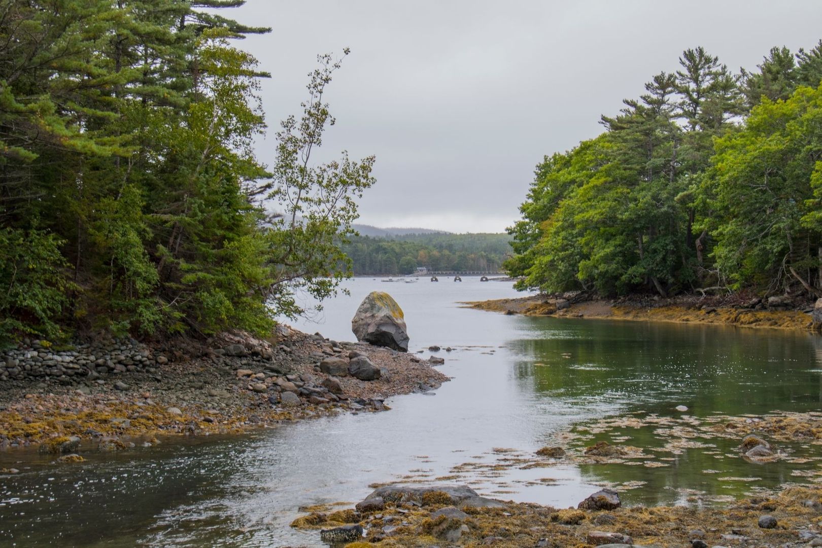
Hydraulic violence at Mahar Point is also ecological opportunity. Strong tidal exchange stirs the water column, redistributes suspended material, and brings nutrients into productive nearshore zones. Small baitfish may gather where current boundaries concentrate food, while seals patrol the channel and bald eagles, ospreys, and other coastal birds scan the water from spruce-fringed shorelines. Migratory birds and waterfowl may use nearby coves and exposed intertidal areas, particularly when changing tides reveal feeding ground.
The intertidal vegetation reflects the same physical energy. Cobscook Bay and neighboring Passamaquoddy Bay support varied belts of red, green, and brown macroalgae across rocks, pilings, floats, buoys, and natural seaweed beds. These communities occupy different levels of the shore according to their tolerance for exposure, immersion, light, and wave action. Brown algae can form substantial low- and mid-tide growth, while red and green algae add structural and seasonal diversity. Together, these plants provide shelter and feeding surfaces for small invertebrates, juvenile fish, and other organisms that support the wider food web.
Turbulent coastal environments also require careful monitoring. Maine”s Department of Marine Resources uses aquaculture oversight, shellfish tracing, field inspections, and newer remotely operated vehicle technology to gather information in complicated nearshore settings. The agency”s Summer 2025 DMR Public Health and Aquaculture Newsletter describes expanded ROV capabilities, including sonar, high-resolution video, and real-time location tracking. The same newsletter discusses harmful algal blooms, oxygen depletion, shellfish toxins, and the importance of reducing nutrient pollution. These concerns do not make every visit hazardous, but they reinforce a central field-naturalist principle: visually impressive water is part of a living and monitored system, not merely a recreational backdrop.
- Watch current seams for baitfish activity, but keep binoculars trained from dry ground.
- Scan elevated trees and exposed snags for eagles and ospreys before approaching the shoreline.
- Look for seals at a distance and avoid calling, feeding, or moving toward hauled-out animals.
- Observe seaweed belts without pulling specimens, turning rocks, or disturbing attached marine life.
- Do not collect shellfish for consumption unless current state and local safety information confirms that the area is open and suitable.
Shoreline Field Guide and Safe Observation Protocol
The Reversing Falls Preserve includes an easy trail network of about 0.6 mile, while the Town of Pembroke owns and maintains 32 acres at Mahar Point, including parking and fields. The hiking path begins near the eastern parking area and follows the wooded shore toward a rocky viewpoint, with spur paths leading toward peninsulas overlooking the falls and Cobscook Bay. Access involves Route 1, Route 214, Leighton Point Road, Clarkside Road, and a local dirt-road approach, so conditions should be checked before arrival. Road and trail conditions can change with rain, frost, fallen branches, and seasonal maintenance.
- Check the tide and weather first. Select a flood or ebb period with strong movement, then build in time to arrive before the most active phase. Wind direction and fog can alter visibility and the apparent shape of the water.
- Use the marked trail and established viewpoints. Stay on durable surfaces and choose a perch with a clear retreat route. A dry, stable position above the water is more valuable than a lower ledge with a closer view.
- Watch the whole channel. Compare smooth water, standing waves, current seams, and rotating patches. A wide view helps reveal how the features move and prevents fixation on one apparently calm area.
- Keep well back from the edge. Wet rock, algae, mud, and spray can make footing unreliable. Sudden surges may reach farther than expected, while undertow and lateral current make entering the water unsafe.
- Leave wildlife and the shoreline undisturbed. Keep voices low, do not approach seals or nesting birds, and avoid collecting seaweed, shells, or marine animals. Pack out all waste and follow restrictions concerning fires, camping, ATVs, and snowmobiles.
Swimming and wading are unsafe at Reversing Falls at all times because currents can shift rapidly. Boating belongs only with an experienced local guide who understands the channel, tide, weather, and submerged ledge. Even experienced paddlers should treat a calm-looking interval as temporary, not as permission to enter. Essential equipment for shore observation includes binoculars, a tide book or current tide application, a waterproof notebook, sturdy footwear with reliable traction, and layered wind protection. A small flashlight is sensible for visitors who may return near dusk, while a dry bag protects phones and field notes from spray and sudden showers.
Plan Your Vigil by the Reversing Tide
Mahar Point makes the forces of the coast unusually legible. Lunar gravity establishes the rhythm, the broad Bay of Fundy tidal system supplies the volume, and the submerged ledge converts that movement into standing waves, boils, and reversing currents. At the same time, the turbulence feeds a productive intertidal world of macroalgae, baitfish, seals, raptors, and shorebirds. The falls are therefore both a hydraulic spectacle and a living coastal food web.
For the richest visit, plan around a strong mid-tide phase, arrive early, and remain on stable ground long enough to observe the direction change. Return during a different lunar phase or tidal stage to compare the channel”s behavior, since a neap tide and a spring tide can produce markedly different surfaces. Quiet observation, careful distance, and respect for trail and wildlife restrictions allow the falls to be experienced without adding pressure to a demanding shoreline. At Cobscook Bay, the most rewarding field skill is patience: watch the water until its hidden structure begins to show.