
Feast on the Falling Tide: Shorebird Stopovers and Mudflat Life in Cobscook Bay

Rhythms of Mud and Water in Eastern Maine
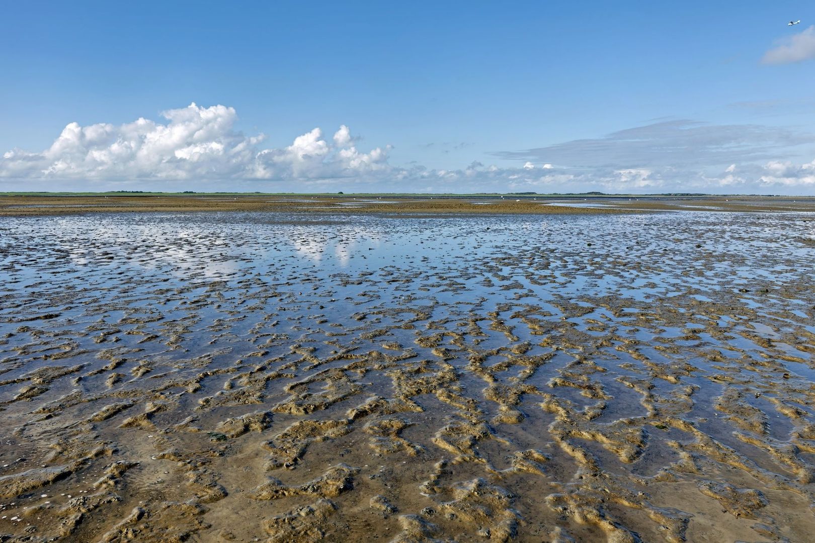
Cobscook Bay moves on an unusually large scale. Around the eastern Maine coast, the tide can rise and fall by roughly 20 feet, changing a broad shoreline from submerged rockweed shallows to exposed mud and gravel within a single tidal cycle. As water drains from coves and channels, an immense intertidal pantry appears: worms, clams, amphipods, small crustaceans, and other invertebrates concentrated in sediment that may look empty at first glance.
Late summer and autumn bring thousands of southbound shorebirds from Arctic and subarctic breeding grounds. Semipalmated Sandpipers, yellowlegs, plovers, dowitchers, and related migrants spend days or weeks feeding on these flats before continuing toward South America. The bay becomes more than a scenic shoreline when its timing is understood. A visitor who follows the tidal cycles, watches feeding behavior, and gives birds room can witness a precise ecological exchange between lunar motion, mudflat life, and long-distance migration.
The Macrotidal Engine and the Cobscook Basin
Cobscook Bay lies within the wider Gulf of Maine and Bay of Fundy tidal system, where the shape and confinement of the basin amplify the movement of water. Resonance within the bay, combined with its complex arrangement of islands, coves, ledges, and shoals, helps produce the exceptional vertical range. The result is not simply a higher high tide and a lower low tide. It is a powerful daily engine that repeatedly stirs, sorts, and redistributes nutrients across the shoreline.
At high water, shallow rocky areas support rockweed and other marine vegetation, while suspended particles move through narrow channels. As the tide falls, water drains from these shallows and leaves wide sediment plains shining beneath the changing light. Small channels continue to carry current across the flats, creating damp feeding margins even before the lowest areas are fully exposed. The pattern varies with wind, weather, shoreline shape, and the phase of the lunar cycle, so no two visits present precisely the same mudflat.
Ecologists describe Cobscook as a naturally eutrophic boreal, macrotidal estuary, meaning that its physical setting supplies unusually strong renewable energy and nutrients. An emergy analysis of Cobscook Bay estimated that tides and wave action contributed 84 percent of the bay’s renewable emergy input in the study model. That energy supports brown algae, benthic communities, filter feeders, and the microalgae and detritus that underpin the food web. The same currents can also resuspend sediment and spread human-caused changes, which makes careful management of aquaculture, dredging, and shoreline development essential.
Beneath the Silt: The Engine of Corophium volutator
One of the less conspicuous but important residents of these flats is Corophium volutator, a small mud amphipod that lives in U-shaped burrows. The species is native to Atlantic Europe but has become established along parts of the North American coast, including the Gulf of Maine and Bay of Fundy. It tolerates broad ranges of temperature and salinity and can become locally abundant in the soft sediments used by migrating shorebirds.
The amphipod grazes on benthic microalgae and consumes detritus, suspended particles, and phytoplankton. Its burrowing disturbs the surface layer of mud, influencing sediment stability and the movement of organic material. Near a moving tide line, active individuals may swim or move close to the wet edge, where feeding birds can reach them. A flock of sandpipers working along a narrow waterline may therefore be tracking a changing prey boundary rather than feeding randomly across the entire flat.
Amphipods are only one part of the menu. Polychaete worms, juvenile soft-shell clams, small bivalves, and other invertebrates convert algae and organic matter into concentrated animal tissue. Research in eastern Maine has shown that predation strongly affects juvenile clam survival, with tidal position influencing both survival and growth. That finding illustrates why different portions of a flat support different prey communities and why birds distribute themselves in bands.
| Intertidal setting | Typical conditions | Likely ecological value |
|---|---|---|
| Upper intertidal margin | Exposed longer, often firmer and more vegetated | Roosting areas, clams, worms, and insects near marsh edges |
| Middle mudflat | Fine sediment with active burrows and shallow drainage channels | Amphipods, worms, microalgae, and feeding opportunities for sandpipers |
| Lower intertidal edge | Remains wet longer and is reached by moving tidal water | Concentrated prey along the waterline and access for wading yellowlegs |
This zonation is a useful field lesson. A flat that seems quiet at high tide may become crowded as the surface emerges, while the most productive feeding may shift continually toward the draining channels. Patience reveals the connection between what lies beneath the silt and the sudden arrival of birds at the water’s edge.
The Autumn Staging Grounds for Transoceanic Voyagers
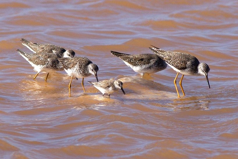
By late summer, young and adult shorebirds begin the southbound leg of a migration that links Arctic nesting grounds with wintering areas in South America. Semipalmated Sandpipers are familiar visitors, often gathering in dense, fast-moving flocks that sweep across the mud like smoke. Greater and Lesser Yellowlegs are more upright and deliberate, stepping through shallow water and probing with their bills. Black-bellied Plovers, sanderlings, dowitchers, and related species add further variety to the autumn assemblage.
The stopover is a physiological necessity. Birds must build substantial fat reserves before flights that may cover approximately 2,000 to 3,000 kilometers, with some ocean crossings requiring prolonged travel without a suitable landing site. Feeding is therefore not merely an opportunity for observation. Every hour spent probing, pecking, and resting contributes to the fuel budget for the next stage. A disturbance that sends a flock into the air interrupts feeding and consumes energy that cannot easily be replaced elsewhere.
As documented in the Maine migratory shorebird assessment, coastal staging areas provide essential places for birds to rest and accumulate fat between breeding and wintering grounds. Maine law also recognizes qualifying shorebird feeding and roosting sites as significant wildlife habitat, with protective buffers around designated areas. The detailed findings compiled in the state’s comprehensive migratory shorebird assessment show why coastal staging zones along Downeast mudflats provide irreplaceable fuel reserves that prevent flock collapse during ocean crossings.
- Semipalmated Sandpipers commonly feed by rapid surface pecking and probing in soft mud, often concentrating where small prey are exposed.
- Lesser Yellowlegs tend to appear slimmer and more finely proportioned, with a relatively straight, narrow bill and a quick, active gait.
- Greater Yellowlegs are larger and heavier billed, with a more substantial body and a noticeably longer, often slightly upturned bill.
- Dowitchers frequently use rapid, repeated probing, sometimes appearing to stitch the mud with their bills.
Identification is easiest when several species stand together. Size can be misleading when distance, posture, or wind ruffles feathers, so compare bill length, body bulk, leg proportions, and feeding style rather than relying on a single feature.
Field Timing and Strategic Vantage Points Along the Bay
Timing an outing to Cobscook Bay requires understanding how the massive tidal amplitude dictates bird distribution. In a macrotidal estuary with vertical drops reaching 20 feet, arriving at dead low tide exposes hundreds of yards of mud, pushing foraging flocks far out into the basin beyond the reach of standard binoculars and spotting scopes. Local ornithologists and experienced birders generally recommend observing during an incoming tide (mid-flood) or the early falling tide. As the water advances, incoming currents gently push feeding flocks closer to firm shoreline bluffs and high-tide roosts, offering excellent vantage points without intruding onto wet mud. Weather also matters: fog, strong wind, heavy rain, and bright glare can reduce visibility, while calm overcast conditions often make subtle plumage differences easier to evaluate.
For elevated, low-impact observation, naturalists frequently utilize the trails and shoreline perspectives associated with the Edmunds Division of Moosehorn National Wildlife Refuge. The Edmunds Division lies along U.S. Route 1 in Edmunds Township between Dennysville and Whiting, directly across the highway from Cobscook Bay State Park. It features an extensive network of service roads and footpaths crossing mixed boreal woodlands, tidal marshes, bogs, and rocky shoreline. Spotting scopes set up along the refuge’s coastal trails allow clear views into protected tidal coves and saltmarsh edges without disturbing resting birds.
Other authorized public vantage points around the bay include Horan Head and the Commissary Point / East Stream Trail area, as well as headland lookouts at nearby Quoddy Head State Park. When planning field trips, naturalists should note that shore access rules and property statuses vary significantly around Downeast Maine. Tide Mill Organic Farm in Edmunds is an active, privately owned commercial organic farm, not a public park or wildlife refuge; visitors must respect working agricultural land and should never attempt shoreline access without prior landowner permission or participation in scheduled farm tours. Additionally, while the South Lubec Sand Bar was historically mentioned in regional birding lore, the Maine Department of Inland Fisheries and Wildlife (MDIFW) maintains a standing advisory requesting that the public avoid visiting the South Lubec Sand Bar due to sensitive access disputes and parking conflicts with neighboring private landowners. Birders should bypass restricted sites and rely on clearly marked public facilities such as Cobscook Bay State Park, where established overlooks protect both habitat integrity and private land boundaries.
- Bring binoculars or a high-magnification spotting scope mounted on a sturdy tripod rather than relying on proximity for identification.
- Use a tide chart calibrated directly to Cobscook Bay, taking into account that narrow channels and sheltered coves can delay local water movement relative to open ocean stations.
- Time visits for mid-flood or early ebb stages of the cycle to keep foraging birds within optical range along shoreline margins.
- Allow extra time for roadside parking, muddy approaches, changing visibility, and a slow walk to an overlook.
- Watch mixed flocks before attempting identification, noting which birds feed on the surface and which wade or probe in deeper water.
Ethical Viewing on Fragile Tidal Margins
Shorebirds arrive with a narrow energy margin. A flock repeatedly flushed from a roost or feeding flat loses time, burns fat, and may be forced to abandon the richest section of habitat. The problem is cumulative: several small disturbances by walkers, dogs, vehicles, or photographers can remove a meaningful portion of a bird’s feeding day. Protection therefore depends as much on visitor behavior as on formal habitat designations.
- Keep a generous distance. If birds become alert, bunch tightly, stop feeding, or repeatedly look toward you, increase the distance. A long lens and a spotting scope produce better observation than a close approach.
- Stay on firm ground and established routes. Soft mud can conceal channels, damage burrows, and trap an unwary visitor. Avoid walking across feeding flats, roosts, saltmarsh vegetation, or areas occupied by resting birds.
- Control dogs and avoid chasing images. Even a leashed dog can cause a flock to flush when it approaches a narrow roost. Follow site-specific rules and choose observation points that keep animals and people away from birds.
- Keep an eye on the incoming tide. Channels can refill quickly as nearly 20 vertical feet of water returns to the bay. Never cross a drainage channel or venture onto exposed ground without a clear retreat route.
- Leave the shoreline as found. Do not collect shells, disturb burrows, move driftwood near roosts, or create new paths through sensitive vegetation.
Protected habitat is not necessarily safe for unrestricted access. Maine’s significant wildlife habitat framework recognizes feeding areas and roosting areas separately, including surrounding buffers intended to reduce disturbance. Quiet observation from a stable vantage point is usually the most valuable form of participation, giving birds the space to feed while allowing naturalists to see behavior that a close approach would disrupt.
Deepen Your Watch on the Downeast Shore
A shorebird flock on Cobscook Bay carries the geography of an entire hemisphere. Its members may have nested on Arctic tundra, replenished their reserves in Downeast mud, and continued toward wintering shores thousands of miles away. Beneath that journey lies the daily work of amphipods, worms, clams, algae, tidal currents, marshes, and sediment. The spectacle is powerful precisely because it is connected to so many less visible processes.
For a responsible visit, check local tide tables, confirm current access information, pack optics, dress for wind and fog, and leave enough time to watch without rushing. Let the tidal flow set the pace. From a quiet overlook, the changing waterline becomes a guide to bird behavior, and careful observation becomes a practical form of stewardship for one of Downeast Maine’s most important migration landscapes.