
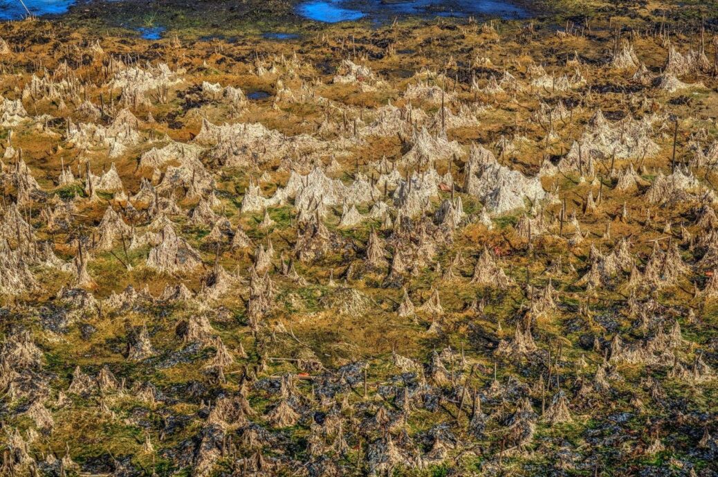
Treading Lightly on Peat and Cordgrass: The Hidden Costs of Foot Traffic in Cobscook’s Salt Marshes

Beneath the Surface of Cobscook Bay
Cobscook Bay is a sub-boreal estuarine landscape shaped by cold water, spruce-lined shores, fog, working waterfronts, and one of the most dramatic tidal ranges on the Maine coast. The bay”s semi-diurnal tides produce two high waters and two low waters during most lunar days, with a tidal swing that can approach 20 feet. Mudflats gleam briefly in changing light, channels fill and empty, and rocky shelves emerge where open water stood only hours earlier.
That rugged appearance can be misleading. A salt marsh may look like a tough carpet of grass, but beneath the stems lies a layered physical structure of roots, rhizomes, fine sediment, water-filled pores, and partially preserved plant material. Repeated footsteps do not merely bend grass. They can compress peat, shear root mats, redirect drainage, and create a small scar that becomes larger with every tide. The purpose of careful travel is therefore not simply to avoid visible plants. It is to understand what happens underfoot and choose routes that let you observe the shoreline without weakening its natural defenses.
The Anatomy of Sub-Boreal Peat and Cordgrass Roots
Salt-marsh peat develops slowly. Each season adds stems, leaves, roots, and rhizomes to the marsh surface. In waterlogged ground, oxygen is limited, decomposition proceeds slowly, and organic matter can accumulate rather than disappear completely. Over many generations, this creates a layered matrix that may contain dark, fibrous peat above finer mineral sediment. In a cold sub-boreal setting, short growing seasons and cool conditions further reinforce the impression of a landscape built through patient accumulation.
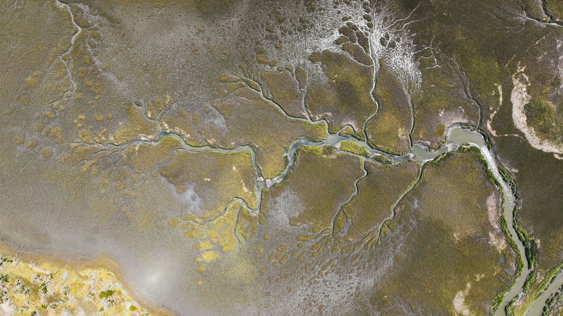
Smooth cordgrass, Spartina alterniflora, commonly occupies lower marsh zones that are flooded regularly by tides. Its underground rhizomes and dense roots help bind sediment while allowing the plant to tolerate saltwater immersion. Saltmeadow cordgrass, Spartina patens, generally grows higher in the intertidal profile, where flooding is less frequent. Its wiry stems and interconnected root system help hold the upper marsh together, but the mat is not a walking surface designed for concentrated human traffic. Understanding the region”s tidal marsh natural communities helps explain why subsurface root structures cannot rebound quickly after repeated footfalls.
The difference between mineral sediment and organic peat matters when a boot applies force. A compact gravel spit or exposed granitic ledge distributes weight across a firm, relatively stable surface. Peat behaves differently. It contains interconnected voids, moisture, fibrous material, and weak layers that can deform under pressure. A single step may leave only a shallow mark, but repeated traffic along the same line can turn a flexible plant mat into a compressed track with altered drainage.
- Lower marsh cordgrass helps trap sediment and reduce the movement of fine particles during tidal exchange.
- Upper marsh cordgrass forms a dense but vulnerable turf that can tear where foot traffic concentrates.
- Peat layers store water and organic material, making recovery slower than it appears from the surface.
- Mineral shorelines, including bedrock and coarse gravel, usually tolerate brief passage better than saturated organic turf.
What Compression Actually Does to the Soil Matrix
Foot traffic affects marsh ground through both compression and shear. Compression pushes downward, reducing the size of pores between roots, fibers, and sediment grains. Shear acts sideways and can tear the interwoven root and rhizome network, especially when a boot twists, slips, or pulls free from soft mud. Lugged soles improve traction for the visitor, but their projecting edges can puncture the surface and concentrate force into small points.
When pore space collapses, water and air move less freely through the substrate. Roots and rhizomes require oxygen for normal respiration, yet compacted peat can remain saturated for longer periods. The result is not simply a footprint. It may be a small zone of altered water movement in which saltwater pools, fine sediment settles, and plant recovery becomes difficult. In places where vegetation is already stressed by flooding, ice, drought, or seasonal dieback, added mechanical damage can push a margin past its ability to repair itself.
Repeated steps also create artificial micro-gullies. A shallow depression catches runoff and tidal water, then directs it along the traffic line. Each incoming and outgoing tide removes a little more loose material from the track. Once the protective grass mat has been broken, erosion can proceed along the route even when visitors are absent. This is why an informal path through marsh turf may remain visible for years, gradually widening as walkers seek firmer footing beside the original rut. Earlier coastal planning work, including the Maine coastal recreation and open space conservation assessment, underscores the importance of directing recreation toward suitable, durable settings rather than allowing access to spread across sensitive shorelines.
| Surface condition | Likely response to repeated foot traffic |
|---|---|
| Exposed granite or bedrock | Generally durable, although slippery algae, wet weather, and unstable edges still require care |
| Coarse gravel or cobble | Usually resilient, but loose stones can shift and may contribute sediment to nearby marsh channels |
| Firm mineral silt | Can bear limited passage when dry, but may become deeply rutted when saturated |
| Organic peat and high-marsh turf | Vulnerable to compression, tearing, drainage changes, and long-lasting scars |
Reading the Tide Table and Choosing Firm Footholds
A safe and low-impact route begins before leaving shore. Check a current tide prediction for the specific part of Cobscook Bay being visited, then allow extra time for uneven ground, photography, wildlife observation, and changing weather. A roughly 20-foot tidal swing can transform a walkable rock shelf into a flooded edge, while a broad mudflat may appear deceptively close to firm ground. Tidal predictions describe water levels, not every local current, wave, channel, or surge, so wind and atmospheric pressure also deserve attention.
When conditions permit, favor lower bedrock shelves, established rocky access points, coarse gravel spits, and older drift lines over elevated peat cushions. Drift lines can reveal where floating material has repeatedly been deposited, but they should not be treated as universally stable, especially after storms. Avoid assuming that a pale, dry-looking strip across a marsh will bear weight. Surface crusts may cover saturated material, and a seemingly firm patch can fail under one step.
- Study the tide and weather together. Note the predicted high and low waters, wind direction, recent rain, fog, and the time needed to return before channels deepen.
- Choose a durable starting surface. Begin on bedrock, established gravel, or another clearly firm substrate rather than crossing marsh turf to reach a better viewpoint.
- Keep the route narrow. If passage across a resilient surface is necessary, use the same line instead of creating several parallel tracks.
- Step over vegetation and creek edges. Do not place weight on cordgrass mats, panne margins, or the soft lip of a tidal channel.
- Turn around early. A rising tide, deteriorating visibility, or unexpected mud is a reason to retreat, not an invitation to search for a shortcut.
Naturalists carrying scopes, cameras, or sampling equipment should distribute weight carefully and avoid kneeling on marsh turf. Foragers need particular restraint because searching for edible plants can multiply disturbance across a broad area. Sea kayakers and shore-based observers can often obtain excellent views from water, rock, or gravel, where the need to enter the marsh is reduced. Binoculars, a long lens, and patience frequently provide better wildlife observation than a closer approach that damages nesting or feeding habitat.
Recognizing Fragile Marsh Pannes and Drainage Creeks
Salt pannes are shallow depressions within a salt marsh. They may hold water after a high tide or rainfall, becoming small, saline basins with distinct microbial, invertebrate, and plant communities. Their margins often feel softer than the surrounding marsh because fine sediment and organic material collect there. A step on the edge can cause the bank to slump inward, filling part of the depression and changing how water enters and leaves.
Pannes and small drainage creeks are also important to wildlife. Shallow water can support tiny invertebrates that feed migrating shorebirds, while creek networks provide routes for tidal exchange and juvenile organisms. Once a cordgrass bank is broken, the next tide can widen the opening. Lateral incision then removes more sediment from the edge, exposes roots, and accelerates channel growth. These features are easy to overlook because they are small, but many small failures can alter the drainage pattern of an entire marsh margin.
- Look for shallow, water-filled depressions surrounded by low cordgrass or bare saline mud.
- Keep well back from creek lips, especially where roots are exposed or the bank appears undercut.
- Never use a panne as a stepping stone, even when its surface looks dry.
- Watch wildlife from a distance and avoid flushing shorebirds from feeding or resting areas.
Carry Forward an Attentive Coastal Ethic
Responsible exploration of Cobscook Bay depends on a simple discipline: read the tide, read the ground, and place every step deliberately. Durable rock, gravel, and established access routes can support observation with far less ecological cost than soft peat. Where a route requires repeated pressure on marsh vegetation, the appropriate choice is usually to stop, change direction, or observe from a distance.
Intact peat margins are more than scenery. They store organic matter, hold sediment, slow erosive water, and provide a living buffer along a coast facing rising seas and increasingly variable weather. Their protection does not require visitors to avoid the shoreline altogether. It requires attention to the difference between a surface that merely looks solid and one that can withstand passage. In Cobscook”s wild salt reaches, the most reliable guide is the landscape itself: watch the water”s timing, respect the creek”s edge, and let the turf remain unbroken beneath the next visitor”s feet.