
Sardines, Weirs, and Smokehouses: How Cobscook Tides Shaped an Industrial Coastline

Reading the Drowned River Valleys of Downeast Maine
Cobscook Bay is best understood as a landscape in motion. Its deeply indented shoreline, exposed ledges, narrow coves, and channels are remnants of a drowned river valley shaped by glacial excavation and later sea-level rise. Twice each day, enormous volumes of Atlantic water enter and leave the bay. The tidal range commonly reaches about twenty-four feet, although local conditions vary, and currents can accelerate sharply around headlands and constricted passages. The dramatic marine dynamics of Cobscook Bay create one of the most powerful and biologically productive estuary systems in North America.
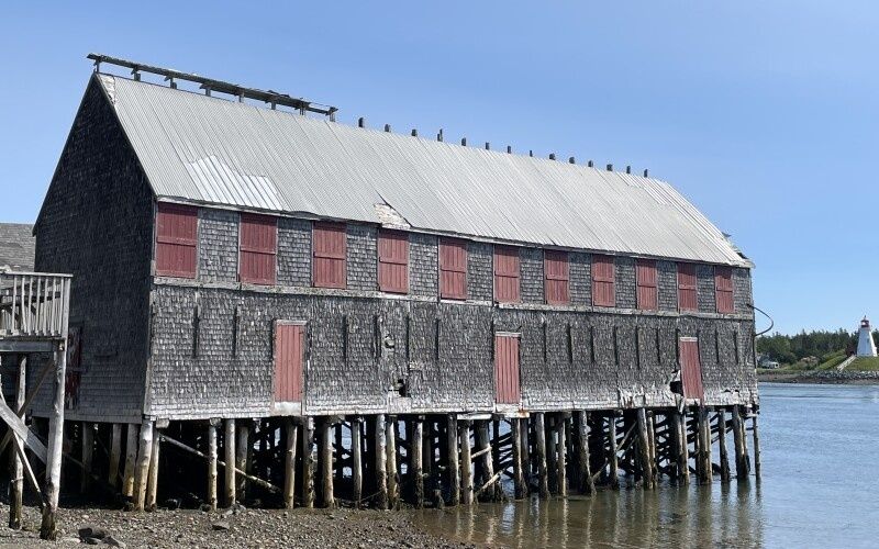
Those forces did more than determine where fish gathered. They dictated where people could build, how boats approached shore, and which structures could survive repeated flooding and exposure. Around Eastport and Lubec, industrial buildings were placed close to navigable water, often on substantial timbers or pilings so that lighters and dories could work beside them at changing stages of the tide. The shoreline still carries traces of that adaptation: weathered posts emerging from mud, squared timbers below old wharf lines, rusted hardware, and smokehouses whose darkened boards recall the period when herring moved from tidal traps into a national food supply.
The Anatomy of Extreme Tides and Natural Fish Traps
The physical form of Cobscook Bay explains much of its historic fishing economy. Glacial valleys cut into bedrock became long coves and sheltered inlets, while uneven shorelines created pockets where tidal water accelerated, eddied, and spread across broad flats. The outer bay, exposed toward the Gulf of Maine and the Bay of Fundy, receives stronger wave action and more direct exchange with open water. Inner passages are more protected, but their narrow entrances can intensify currents. A calm-looking cove at one stage of the tide may become a rushing channel a few hours later.
These conditions were especially useful for catching schooling fish. Atlantic herring move through coastal waters in dense groups, and juvenile herring historically entered shallow indentations where the combination of shoreline shape, tidal flow, and available food concentrated them. A brush weir did not need to overpower the sea. Properly positioned, it guided fish with the water”s own movement toward a confined pocket where they could be harvested at low tide. The bay”s geography therefore served as a kind of natural trap, with human-built structures completing the pattern.
Hydrography differed considerably among Downeast fishing grounds. Cobscook”s inner coves offered shelter and broad intertidal areas, while the waters around Eastport and Lubec connected working harbors to more exposed channels. Nearby Passamaquoddy Bay and the open approaches toward the Bay of Fundy could produce stronger swell, colder exposure, and more demanding navigation. The comparison below is a practical guide rather than a fixed timetable, since wind, lunar phase, and atmospheric pressure alter local conditions.
| Fishing ground | Typical physical character | Historic advantage |
|---|---|---|
| Inner Cobscook coves | Sheltered channels, mudflats, and complex shoreline pockets | Suitable settings for fixed weirs and protected handling areas |
| Eastport waterfront | Deep working-water access beside a heavily indented shore | Convenient for canneries, wharves, storage, and coastal shipping |
| Lubec approaches | Exposed passages mixed with sheltered harbor edges | Connected fishing grounds with processing and export facilities |
| Outer Downeast shore | More direct ocean swell and open-water exposure | Access to migrating fish, but greater risk for small craft and shore structures |
Brush Weirs and Woodcraft Driven by the Water Table
Long before sardine canneries appeared, Passamaquoddy communities developed detailed knowledge of tidal fish movement, seasonal abundance, and shoreline materials. The Passamaquoddy are members of the Wabanaki Confederacy, whose fishing traditions in eastern Maine and Atlantic Canada extend back thousands of years. At the Waponahki Museum and Resource Center in Pleasant Point, fisheries heritage materials describe the use of distinctive double-curve fish weirs and the importance of species including herring, pollock, cod, flounder, and tomcod. Passamaquoddy people later participated in the commercial herring economy as weir operators, factory workers, and makers of specialized fish baskets.
A traditional brush weir depended on careful reading of the shore rather than mechanical power. The exact form varied, but construction generally followed a practical sequence:
- Choose the site. Builders selected a shallow intertidal area where the slope, current, and fish passage favored accumulation, often near a cove or channel entrance.
- Set the framework. Spruce poles or other durable stakes were driven into the seabed in curved or angled lines that directed fish toward a narrower pocket.
- Weave the barrier. Birch brush and other branches were interlaced through the poles, leaving enough permeability for water to move while discouraging fish from passing through.
- Shape the pocket. The terminal section created a holding area that could be reached as the tide ebbed, allowing fish to be gathered without hauling a large net through deep water.
- Tend the structure. Storms, ice, floating timber, and tidal scour demanded regular repairs, especially during periods of heavy spring runoff or autumn weather.
Cobscook Bay offered the precise topography that made this method efficient. A steep intertidal zone could provide a strong difference between high and low water, while a protected indentation reduced the need for massive engineering. The tide supplied both movement and timing. During the spring and summer fishing season, crews monitored the condition of brush, watched for breaks, and coordinated harvests with the falling tide. By late autumn, deteriorating materials, ice, and rough weather made dismantling or abandoning a seasonal structure sensible. What appears today as a few irregular stakes in mud may once have been part of a carefully calculated shoreline machine.
Canneries and Smokehouses Built on Water Stilts
The nineteenth-century sardine boom expanded this tidal knowledge into a larger industrial system. Eastport was the site of America”s first sardine cannery, opened by Julius Wolff in 1875. Maine”s sardine industry eventually grew to approximately seventy canneries and reached production of 344 million cans, according to the Cobscook Bay Resource Center”s fisheries history. Lubec and Eastport became central to that network because their position combined access to productive fishing grounds, sheltered working water, established maritime skills, and routes for moving processed food beyond the coast.
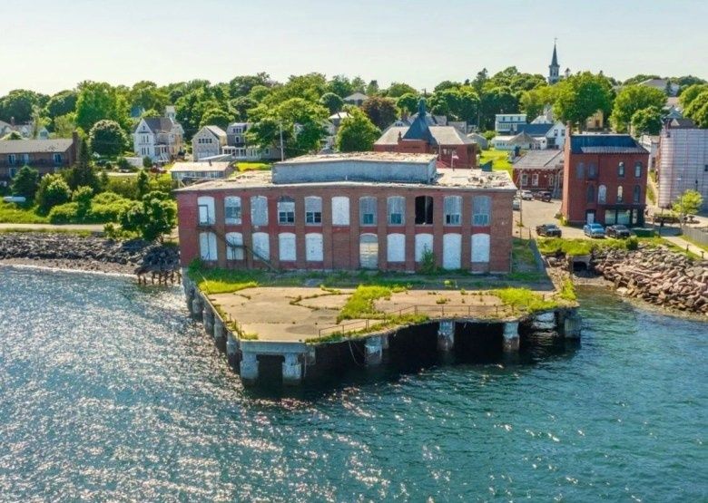
Waterfront architecture had to accommodate the extraordinary vertical movement of the tide. Packing houses stood close enough to the shore for fish to be transferred from dories and lighters, but their floors and foundations had to withstand wetting, drying, ice, and salt. Elevated sections, heavy wharf timbers, ramps, and open working areas allowed operations to continue across a broad tidal range. A building that looked oversized from land often reflected a practical need to align boats, receiving floors, storage rooms, and shipping points at different stages of the tide.
Smokehouses served a related but distinct purpose. Their construction favored controlled airflow and steady heat rather than the bright, open conditions of a cutting room. Slatted louvers helped regulate smoke and ventilation, while slow-burning hardwood fires produced the dry, persistent heat required for preserving herring. Inside a busy coastal operation, the work was divided into specialized tasks:
- Fishers and weir crews supplied fresh catches and maintained gear in demanding tidal conditions.
- Receivers and sorters weighed fish, separated sizes, and moved the catch rapidly before quality declined.
- Cutters and cleaners prepared fish at long tables, removing unwanted material with speed developed through repetition.
- Packers arranged fish in cans, often under strict piece-rate systems that rewarded rapid, accurate work.
- Steamers and cooks applied heat in stages, balancing texture, flavor, and preservation.
- Can sealers and labelers closed, inspected, and prepared finished products for shipment.
Archival records accessible through the Maine State Archives, together with an Authoritative Source on the region”s sardine history, illustrate the rigorous daily labor inside these waterfront complexes. The R.J. Peacock Canning Company papers, held by the Penobscot Marine Museum, further document the development of the Lubec sardine fishery, the company”s plants in Lubec, Eastport, and Portland, and production that continued in Lubec into the 1990s. These records help restore human scale to the surviving foundations. A piling was not simply part of a wharf; it supported a workplace connected to fishing schedules, factory shifts, machinery, shipping, and family livelihoods.
A Field Guide to Spotting Industrial Relics Along the Waterline
Low tide is the most revealing time for reading Cobscook”s industrial shoreline, but it is not automatically the safest. Old weir remains may appear as short, evenly spaced stakes projecting from mud or as broken lines that curve toward a former holding pocket. Their regular spacing and alignment distinguish them from scattered driftwood. Some are nearly level with the mud and visible only when sunlight catches their wet surfaces. Others may be obscured by eelgrass, rockweed, shell deposits, or recent sediment.
Abandoned wharf pilings are usually more substantial than weir stakes. Look for squared or roughly cylindrical timbers arranged in parallel lines, often near a natural landing place or the edge of an old harbor. At Sipp Bay Preserve and around Hamilton Cove, shoreline observation can reveal how old structures relate to the terrain, but visitors should avoid treating every dark branch or upright snag as a historic artifact. Driftwood collects in similar patterns, especially after storms. The strongest clues are repeated spacing, cut surfaces, metal fasteners, and a logical relationship to a former building, road, or landing area.
Lubec”s working harbor retains reminders of the processing era in old waterfront alignments, surviving foundations, and structures associated with former packing operations. The R.J. Peacock collection is particularly useful for understanding how a cannery could change over several generations while remaining tied to the same harbor geography. Historic buildings and working waterfronts are not museum cases, however. Some properties are private, some remain structurally hazardous, and some apparent ruins may be connected to active marine businesses.
- Check tide information before leaving shore. A mudflat that seems walkable can become cut off or covered surprisingly quickly.
- Stay on public land and marked paths. Do not cross wharves, yards, or shore facilities without permission.
- Wear footwear suited to unstable ground. Mud can be deep, adhesive, and difficult to escape without assistance.
- Keep clear of pilings and collapsing structures. Old timber may conceal nails, sharp metal, unstable footing, or sudden drop-offs.
- Carry a charged phone and tell someone the route. Fog, rain, and early darkness can make shoreline orientation difficult.
- Leave artifacts in place. Moving timbers, baskets, cans, or hardware removes evidence from the historic landscape and may damage protected sites.
For broader coastal orientation, Quoddy Head State Park provides public trails, rocky beaches, bogs, ocean views, and access to the landscape around West Quoddy Head Lighthouse. The WQHLKA Visitor Center and Museum is closed for restoration as of November 2026 and is expected to welcome visitors in 2027. The state park”s regular visitor season is listed as May 15 through October 15, with off-season access available by parking outside the gate and walking in while paying the applicable admission fee. Conditions and access can change, so official information should be checked before travel.
Carrying Maritime Memory Across Shifting Shorelines
Cobscook Bay”s industrial identity was never imposed on a passive coast. The tidal range, drowned valleys, shallow coves, and fast passages determined where fish gathered and where people could work. Passamaquoddy knowledge supplied a foundation for reading those conditions, while later builders translated tidal movement into brush weirs, elevated packing houses, smokehouses, wharves, and shipping networks. Eastport and Lubec grew because their architecture and labor systems fit the water”s schedule.
The sardine economy has disappeared, and herring is now only a minor industry in the region, but the bay remains a productive working ecosystem. Local efforts around scallop management, sustainable aquaculture, conservation, and fisheries education continue the older practice of adapting livelihoods to natural limits. For coastal travelers, the most meaningful heritage trail may be an attentive one: watch the waterline move, examine the pattern of old timbers, respect active properties, and allow enough time for fog, weather, and tide to change the view. Along this coast, maritime history is not sealed behind glass. It remains visible in the spaces that the tide uncovers and covers again.